
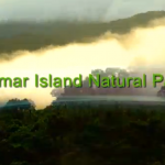
VIDEO: The Samar Island National Park and Samar’s Amazing Interior
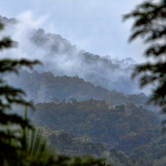
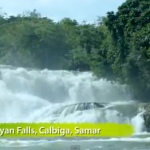
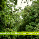
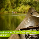
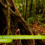
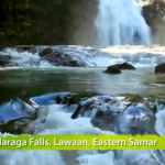
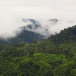
Typhoon Yolanda has caused us to focus of the coastline of Samar, but last night I started thinking about the interior. I realized that because the population is concentrated along the coast, that’s where much of the focus is — but the interior of the island is fascinating in its own right. First of all, understand that Samar is the third largest of the 7,200 islands that make up the Philippines. The interior is all mountainous jungle…..this means, that among other things, the rivers and streams that come down to the ocean generate spectacuar waterfalls throughout the island.
I spent a good portion of this evening googling and trying to learn more about the interior of Samar — and what I found is very intriguing, starting with this video which is a gem of a well-shot, HD clip of the Samar Island Natural Park. If you find this interesting — keep reading, there’s more.
Consider this:
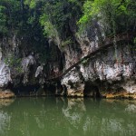
Samar, the third largest island in the Philippines archipelago, contains one of the country’s largest unfragmented tracts of lowland rainforest. The island is of high significance for its global biodiversity, harboring within some 38 species of mammals (50% endemic), 215 species of birds (55% endemic), 51 species of reptiles (69% endemic), 26 species of amphibians (52% endemic) and over 1,000 species of plants (approximately 53% endemic). The forests of Samar, and the other ecosystems of the country, have been widely recognized for their biodiversity. For many years, however, civil unrest on the island hampered the conservation of this rich biodiversity, which faces threats from agricultural encroachment, and unsustainable logging, hunting, and harvesting of non-timber forest products. However, improvements in civil order in the 1990s provided an opportunity to address these threats by expanding and strengthening protected areas (PAs) on the island.
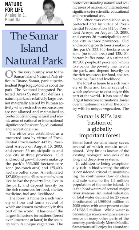
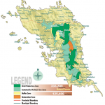
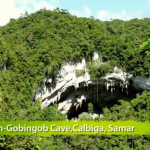
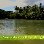
The 455,700 hectare Samar Island Natural Park, the biggest natural park in the country, was declared a protected area on April 13, 2003 by virtue of Presidential Proclamation No. 442. It covers 333,330 hectares of land and a buffer zone of 125,400 hectares of primary forest and a large, contiguous tract of secondary forest in good ecological condition. It boasts of many caves, various wildlife species and river systems such as the navigable, 9-km. long Ulot (a Waray term meaning “monkey”) River, which is within the Ulot Watershed Area, one of Samar’s 8 watershed areas.
Here is the best article I have been able to find on the Samari Island Natural Park — unfortunately it only seems to exist in a Google News Reader scan of the physical Manila times
Legislation — Samar Island Natural Park in the Philippine Senate
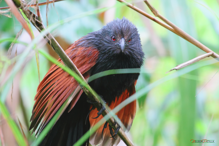
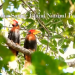
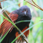
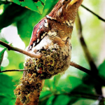
For extraordinary pictures of birds taken in the interior of Samar Island, click on the image below and visit the blog of Nelson Patilla
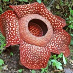
And finally, because it’s midnight and I have to stop this and go to bed, I’m going to load in a gallery of images.
Much to ponder here. I apologize for the slapdash nature of this post, but there’s just a lot of stuff to think about. This is like a bulletin board or scrapbook entry.


Share this:

If you enjoyed this article, please consider sharing it!

